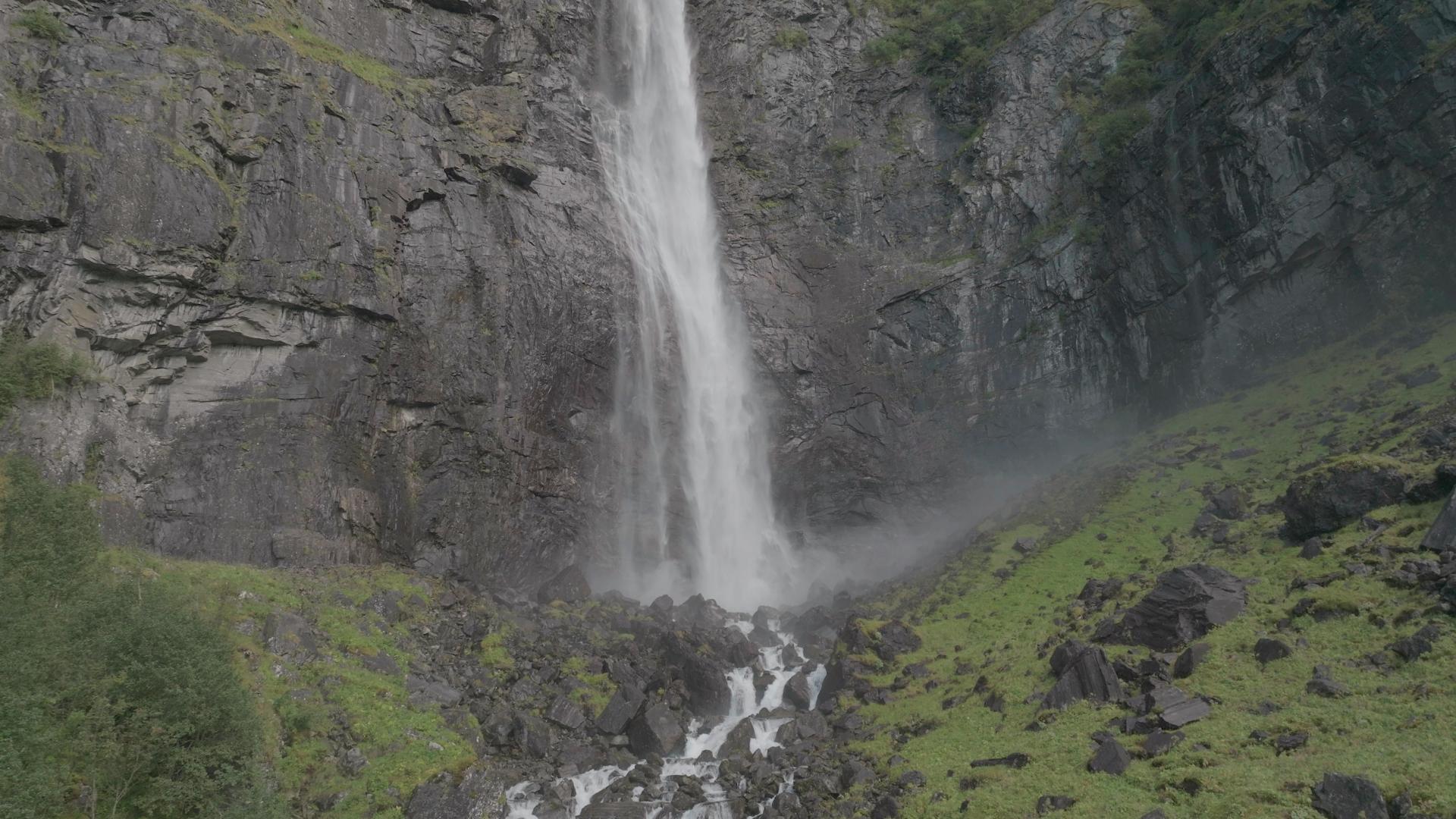
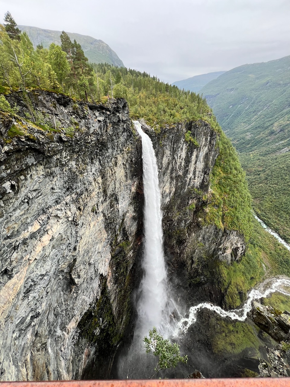
Vettisfossen is Norway's highest unregulated single-drop waterfall at 275 metres. It sits in the scenic Utladalen valley, which connects Sognefjord with the Jotunheimen mountains. Many guides describe this as a quick hike. That's rubbish. The round trip is nearly 15 kilometres with 650 metres of ascent. Plan for six hours total, not the two hours some websites claim. Drive to Hjelle car park at the valley's end. Don't park where the asphalt ends despite what others do - there are clear signs. The trail follows a gravel road built by volunteers between 1972 and 1977, called Folkevegen or the people's road. You'll pass three waterfalls on the way. Hjellefossen at 240 metres right at the car park, then Avdalsfossen at 175 metres, and Hyljefossen which has the greatest water volume despite being only 13 metres high. At Vetti Gård farm, take the mountain trail behind the buildings. It's 45 minutes to the upper viewpoint. The final section has safety fencing - don't climb over it. Norwegian fences mean genuine danger. Unfortunately, drones are banned in this nature reserve.
💧 Waterfall
Sognefjord
Valley
Vettisfossen - Norway's Tallest Protected Waterfall
Open in map
 Medium
60 minutes
Medium Useful Links
Get the free Xplore Norway app
Hear every place narrated automatically as you drive, with offline maps for all of Norway.
- Automatic GPS audio guide
- Offline maps for all of Norway
- Free to download
1425 places across Norway