Difficult
At 1,241 metres, Oksen, the Bull, is widely considered the finest viewpoint in Hardanger. The summit sits at the exact point where four fjord arms converge: Sørfjorden, Eidfjorden, Granvinsfjorden, and Samlafjorden. On clear days the panorama extends from Folgefonna glacier to Hardangerjøkulen. The mountain's profile from several angles resembles a sleeping or running bull, hence the name. The round trip from Tjoflot trailhead is roughly 9.5 kilometres with about 1,060 metres of elevation gain, taking five and a half to eight hours. This is a serious mountain hike with sustained steep ascent and almost no flat sections.
The southern spur of Oksen is named Veten, from Old Norse viti meaning fire signal. This was one of eleven beacons in the Sunnhordland-Hardanger chain, part of the Viking Age and medieval coastal defence network. When hostile ships entered the fjord, a bonfire was lit on Veten, signalling the next station in the chain and mobilising the leidang, the local naval levy. The system remained operational until the end of the Napoleonic Wars around 1814. Hikers can walk from the summit cairn to Veten to stand where the watchmen stood.
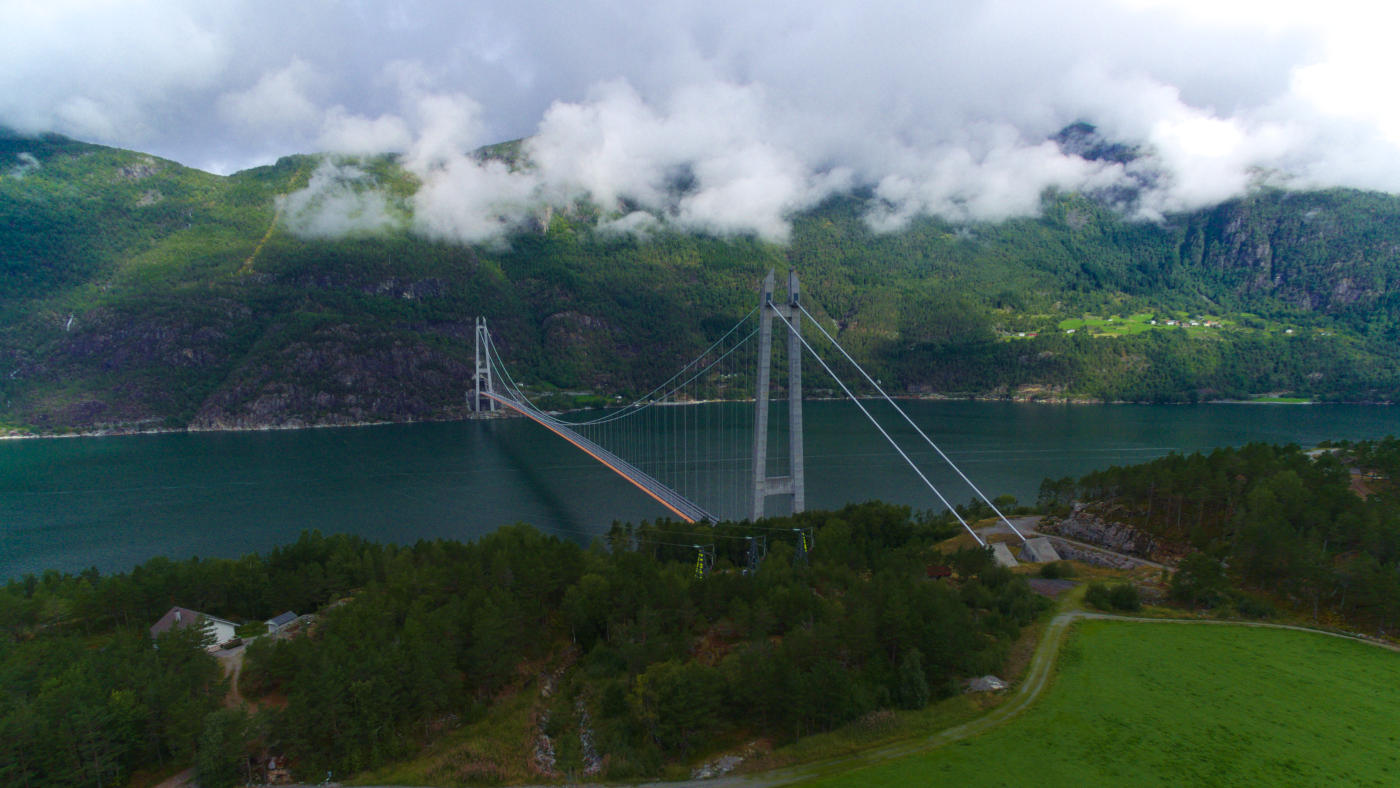
The most popular trailhead is at Tjoflot, reached by exiting the roundabout inside the mountain at the north end of the Hardanger Bridge, opened in 2013 as Norway's longest suspension bridge at 1,380 metres. The trail passes through native forest, past an old sheep shelter with a salt stone, through Verkadalen valley, past the Larsbu hut and Lake Oksatjørni, then up a rocky ridge to the summit cairn.
The southern spur of Oksen is named Veten, from Old Norse viti meaning fire signal. This was one of eleven beacons in the Sunnhordland-Hardanger chain, part of the Viking Age and medieval coastal defence network. When hostile ships entered the fjord, a bonfire was lit on Veten, signalling the next station in the chain and mobilising the leidang, the local naval levy. The system remained operational until the end of the Napoleonic Wars around 1814. Hikers can walk from the summit cairn to Veten to stand where the watchmen stood.
The most popular trailhead is at Tjoflot, reached by exiting the roundabout inside the mountain at the north end of the Hardanger Bridge, opened in 2013 as Norway's longest suspension bridge at 1,380 metres. The trail passes through native forest, past an old sheep shelter with a salt stone, through Verkadalen valley, past the Larsbu hut and Lake Oksatjørni, then up a rocky ridge to the summit cairn.