 Medium
Finnemarka is a large forested wilderness area north of Drammen, stretching some 430 square kilometres between Drammenselva, Tyrifjorden and Lier.
The name comes from Finnish immigrants who settled here from around 1640, practising slash-and-burn agriculture. The first settler recorded by name was Peder Olsen, a Finn from Värmland who arrived in 1648 and built a water-powered lathe by a stream near what is now the Svarvestolen cabin. He became known as "Peder Svarver" (Peder the Turner), and the place took its name from his craft.
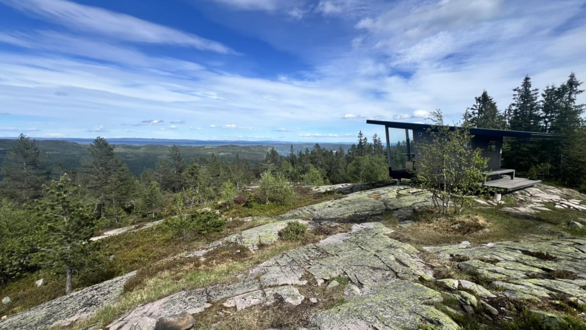
The terrain gives a surprisingly alpine feel considering it's so close to Norway's fifth-largest city. The higher areas have sparse pine forest over bedrock, with bog and small lakes filling the depressions. Brennåsen at 703 m is the highest point in the broader area.
The more accessible southern part, closest to Drammen, is usually called Drammensmarka, with Skimten (554 m) as its highest peak. From the stone cairn at Skimten, you can see as far as Gaustatoppen on a clear day, though the forest has grown up considerably since the view indicator was installed in 1961.
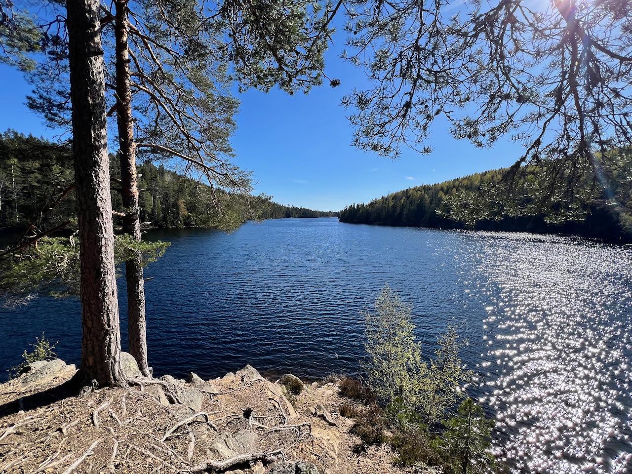
At the centre of Finnemarka lies Glitre, a lake that supplies drinking water to around 130,000 people in Drammen, Lier and several other municipalities. The lake sits in a caldera, a collapsed volcanic crater from the Permian period some 250 million years ago, making it one of the largest calderas in the Oslo Rift geological region. Because of its importance as a water source, there are restrictions around Glitre: no swimming, no boats, no camping within 100 metres.
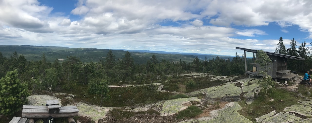
But you can hike, ski and fish everywhere else in the area. The area has several DNT cabins worth knowing about. Goliaten is a charming timber cabin from 1899 with dragon-style decorations, sitting below Tverråsen about 5 km from the Landfalltjern car park.
During World War 2, it was used by the resistance, and weapons were hidden in the Tverråsen cliffs nearby. There's even a secret resistance hideout called "Cella i Tverråsen" less than a kilometre away, built into a boulder with a chimney concealed in a rock crack to hide smoke. A memorial stone marks the Kampen slipplace where British planes dropped weapons and supplies to the resistance in April 1943.
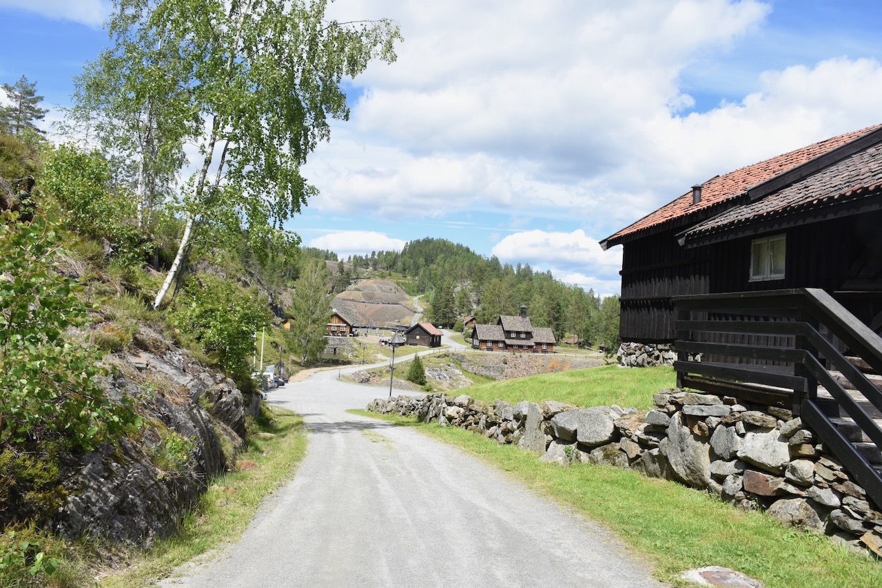
Svarvestolen is another fine cabin, a former Finnish farmstead that was inhabited until 1955 and restored as a tourist cabin in 1993. It sits at 438 m near Glitre and offers a 6 km marked trail past old settlement ruins including a school and bathhouse foundation. The cabin is a living monument to the Finnish pioneers who shaped this landscape.
Tverråsen is also one of Norway's better rock climbing areas, with granite walls offering traditional routes on good protection. Drammen Klatreklubb published a comprehensive guidebook in 2023 covering 1,400 routes on 40 crags in the region. The ascent to the Tverråsen viewpoint via Dronningslepet involves a steep section with fixed ropes.
In winter, Skiforeningen maintains an extensive network of groomed cross-country trails, with Eiksetra and Landfalltjern as the main starting points. Snow typically lingers in the higher areas well into spring.
The terrain suits everything from easy family outings to multi-day cabin-to-cabin tours through the entire forest.
Access: The main car parks are Landfalltjern (toll road from Underlia in Drammen) and Eiksetra (toll road from Egge in Lier, 30 NOK per passage via youpark.no). Both have well-marked trails into the forest. From the Vikersund side, you can access the northern reaches via Engersetra or Geithus.
Public transport is possible but limited: trains to Drammen or Vikersund, then bus to Sylling or the trailheads.
The name comes from Finnish immigrants who settled here from around 1640, practising slash-and-burn agriculture. The first settler recorded by name was Peder Olsen, a Finn from Värmland who arrived in 1648 and built a water-powered lathe by a stream near what is now the Svarvestolen cabin. He became known as "Peder Svarver" (Peder the Turner), and the place took its name from his craft.
The terrain gives a surprisingly alpine feel considering it's so close to Norway's fifth-largest city. The higher areas have sparse pine forest over bedrock, with bog and small lakes filling the depressions. Brennåsen at 703 m is the highest point in the broader area.
The more accessible southern part, closest to Drammen, is usually called Drammensmarka, with Skimten (554 m) as its highest peak. From the stone cairn at Skimten, you can see as far as Gaustatoppen on a clear day, though the forest has grown up considerably since the view indicator was installed in 1961.
At the centre of Finnemarka lies Glitre, a lake that supplies drinking water to around 130,000 people in Drammen, Lier and several other municipalities. The lake sits in a caldera, a collapsed volcanic crater from the Permian period some 250 million years ago, making it one of the largest calderas in the Oslo Rift geological region. Because of its importance as a water source, there are restrictions around Glitre: no swimming, no boats, no camping within 100 metres.
But you can hike, ski and fish everywhere else in the area. The area has several DNT cabins worth knowing about. Goliaten is a charming timber cabin from 1899 with dragon-style decorations, sitting below Tverråsen about 5 km from the Landfalltjern car park.
During World War 2, it was used by the resistance, and weapons were hidden in the Tverråsen cliffs nearby. There's even a secret resistance hideout called "Cella i Tverråsen" less than a kilometre away, built into a boulder with a chimney concealed in a rock crack to hide smoke. A memorial stone marks the Kampen slipplace where British planes dropped weapons and supplies to the resistance in April 1943.
Svarvestolen is another fine cabin, a former Finnish farmstead that was inhabited until 1955 and restored as a tourist cabin in 1993. It sits at 438 m near Glitre and offers a 6 km marked trail past old settlement ruins including a school and bathhouse foundation. The cabin is a living monument to the Finnish pioneers who shaped this landscape.
Tverråsen is also one of Norway's better rock climbing areas, with granite walls offering traditional routes on good protection. Drammen Klatreklubb published a comprehensive guidebook in 2023 covering 1,400 routes on 40 crags in the region. The ascent to the Tverråsen viewpoint via Dronningslepet involves a steep section with fixed ropes.
In winter, Skiforeningen maintains an extensive network of groomed cross-country trails, with Eiksetra and Landfalltjern as the main starting points. Snow typically lingers in the higher areas well into spring.
The terrain suits everything from easy family outings to multi-day cabin-to-cabin tours through the entire forest.
Access: The main car parks are Landfalltjern (toll road from Underlia in Drammen) and Eiksetra (toll road from Egge in Lier, 30 NOK per passage via youpark.no). Both have well-marked trails into the forest. From the Vikersund side, you can access the northern reaches via Engersetra or Geithus.
Public transport is possible but limited: trains to Drammen or Vikersund, then bus to Sylling or the trailheads.