Easy
Easy
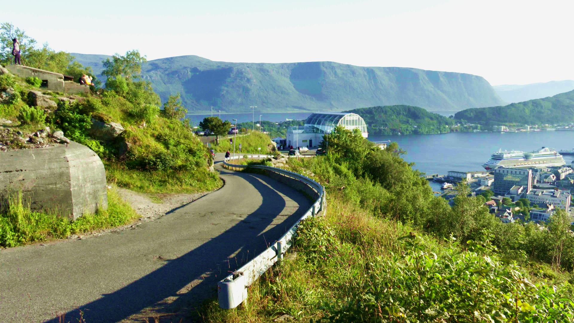
Sukkertoppen is Ålesund's most popular hike. The name means "Sugar Top", probably because of how the mountain looks when covered in snow. It sits on the island of Hessa, just west of the town centre, and reaches 314 metres.
The normal route starts near Hessa school. Follow Sukkertoppvegen road westward and look for the trailhead sign by house number 22. Be aware that the signage is not the best. The trail starts between two houses, and it is easy to walk right past it. From there it is about 1.8 kilometres to the top, with roughly 265 metres of elevation gain. Most people take 30 to 45 minutes if they are reasonably fit. The trail gets extremely muddy after rain, so proper footwear is not optional here.
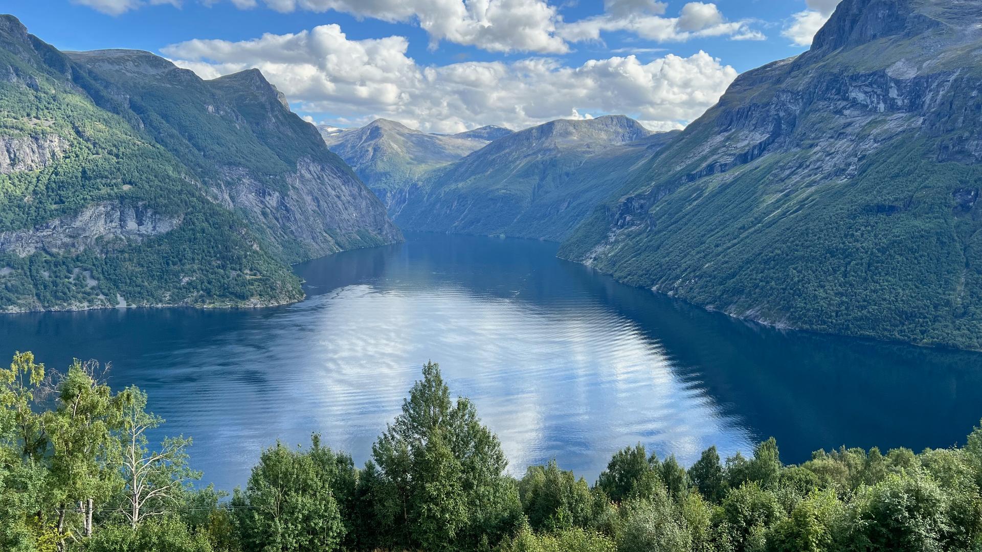
At the summit there is a viewfinder compass that was placed in 1998 for Ålesund's 150th anniversary. You can rotate it to identify all the peaks on the horizon. The view is a full 360 degrees: the town below, the islands, the open Atlantic, and the Sunnmøre Alps in the distance.
One interesting detail is Tyskerstien, "The German Path", a steeper route up the north face. During the Second World War, German soldiers used a plateau partway up as a lookout point and installed a ladder to reach it. The ladder is long gone, but you can still see where it was attached to the rock. That route is only for experienced scramblers though, not a casual walk.
If you only have time for one hike in Ålesund, many locals would tell you to choose Sukkertoppen over the Aksla steps. It takes more effort, but the view is bigger and the crowds are smaller.
The normal route starts near Hessa school. Follow Sukkertoppvegen road westward and look for the trailhead sign by house number 22. Be aware that the signage is not the best. The trail starts between two houses, and it is easy to walk right past it. From there it is about 1.8 kilometres to the top, with roughly 265 metres of elevation gain. Most people take 30 to 45 minutes if they are reasonably fit. The trail gets extremely muddy after rain, so proper footwear is not optional here.
At the summit there is a viewfinder compass that was placed in 1998 for Ålesund's 150th anniversary. You can rotate it to identify all the peaks on the horizon. The view is a full 360 degrees: the town below, the islands, the open Atlantic, and the Sunnmøre Alps in the distance.
One interesting detail is Tyskerstien, "The German Path", a steeper route up the north face. During the Second World War, German soldiers used a plateau partway up as a lookout point and installed a ladder to reach it. The ladder is long gone, but you can still see where it was attached to the rock. That route is only for experienced scramblers though, not a casual walk.
If you only have time for one hike in Ålesund, many locals would tell you to choose Sukkertoppen over the Aksla steps. It takes more effort, but the view is bigger and the crowds are smaller.