Færder nasjonalpark protects 340 square kilometres of islands, skerries, and seabed at the outer edge of the Oslofjorden, making it one of Norway's most accessible national parks. Established in 2013, the park covers the archipelago around Nøtterøy, Tjøme, and Bolærne, with only about 15 square kilometres of actual land. The rest is sea.
What makes the park special is its biodiversity. The warm, shallow waters support kelp forests, eelgrass meadows, and some of the richest marine habitats along the Norwegian coast. On land, rare temperate deciduous forests and old hay meadows survive on islands that have been grazed and farmed for centuries. The birdlife is exceptional, particularly during migration seasons.
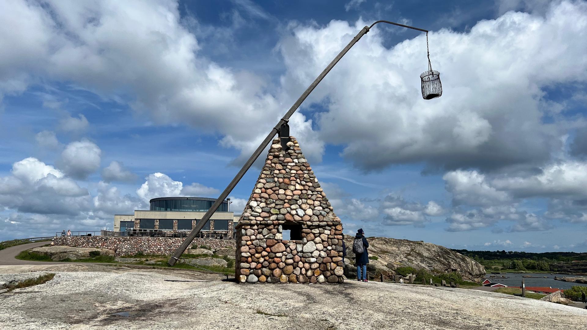
Access is easy from Verdens Ende at the southern tip of Tjøme, where the national park visitor centre provides maps and information. Kayaking, swimming, and island-hopping by boat are the main summer activities. Several islands have simple camping and toilet facilities.
What makes the park special is its biodiversity. The warm, shallow waters support kelp forests, eelgrass meadows, and some of the richest marine habitats along the Norwegian coast. On land, rare temperate deciduous forests and old hay meadows survive on islands that have been grazed and farmed for centuries. The birdlife is exceptional, particularly during migration seasons.
Access is easy from Verdens Ende at the southern tip of Tjøme, where the national park visitor centre provides maps and information. Kayaking, swimming, and island-hopping by boat are the main summer activities. Several islands have simple camping and toilet facilities.