Atlanterhavsveien is an 8.3 kilometre stretch of road connecting small islands along Norway's Atlantic coast. It opened in 1989 and has since become one of the country's most photographed drives.
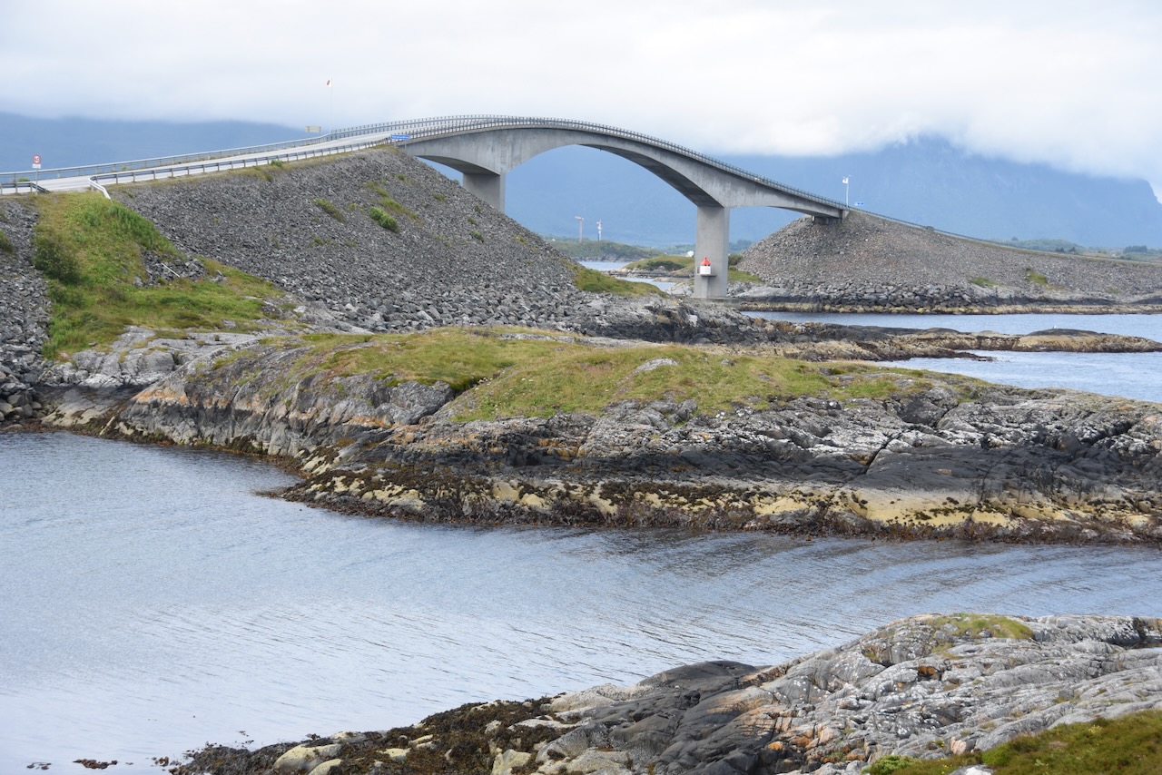
The road hops between islands using eight bridges. The most famous is Storseisundbrua, which curves dramatically over the water. You'll see this bridge in practically every Norway tourism advert.
Here's the honest truth though. Most people find it overrated. The drive takes maybe ten minutes if you don't stop. It's pleasant enough, but hardly the engineering marvel some make it out to be. The road isn't difficult to drive at all, despite what you might have heard about dramatic weather.
If you're already heading along the coast, it makes a decent small detour. But I wouldn't recommend driving hours out of your way specifically for this. The photos online make it look more spectacular than it actually is. The best views come from stopping at the car parks along the way, not from driving.
There are several viewpoints where you can get out and walk around. On calm days it's quite nice. During storms, which happen frequently, it can be genuinely dramatic. The road is part of Norway's National Tourist Route network.