 Difficult
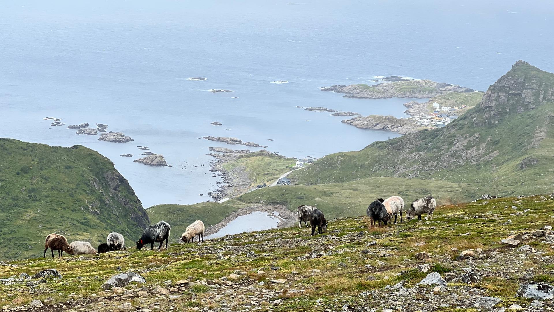
Dronningsruta is often compared to Besseggen, but offers a different mix of coastal scenery and mountain landscape. The trail runs between Stø and Nyksund at the northern tip of Langøya in Vesterålen. It can be started from either end. Stø is the slightly shorter option and can be reached by bus from Sortland. Nyksund has no public transport.
The trail opened in 1992. In 1994, Queen Sonja hiked it and was so taken by the nature that people started calling it Dronningsruta. In 2018, the Norwegian Tourist Association DNT celebrated its 150th anniversary with a series of live television broadcasts of famous hikes led by adventurer Lars Monsen. Dronningsruta was one of them. They did not have sunshine either.
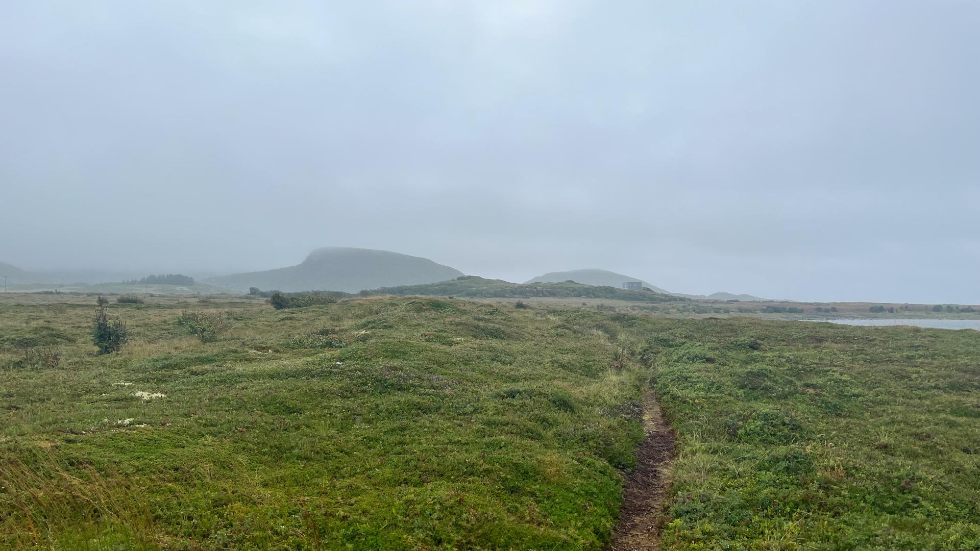
The route is 11.3 km with 800 metres of total ascent. If you extend the hike to include Nyksund, add 2 km and 200 metres. The mountain section runs along a plateau before reaching Finngamheia, where it gets steep. Unlike Besseggen, the ground here is loose earth rather than bare rock, so you have to be more careful on the descent.
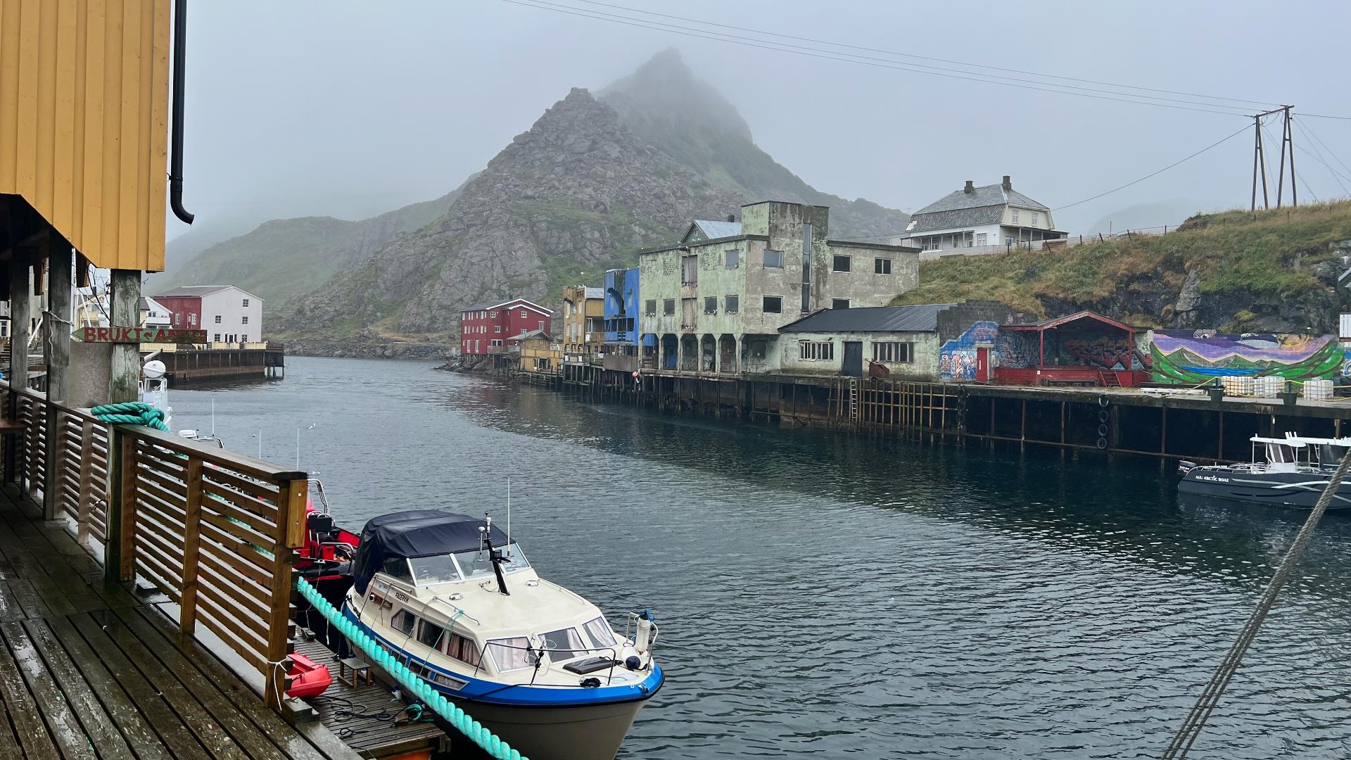
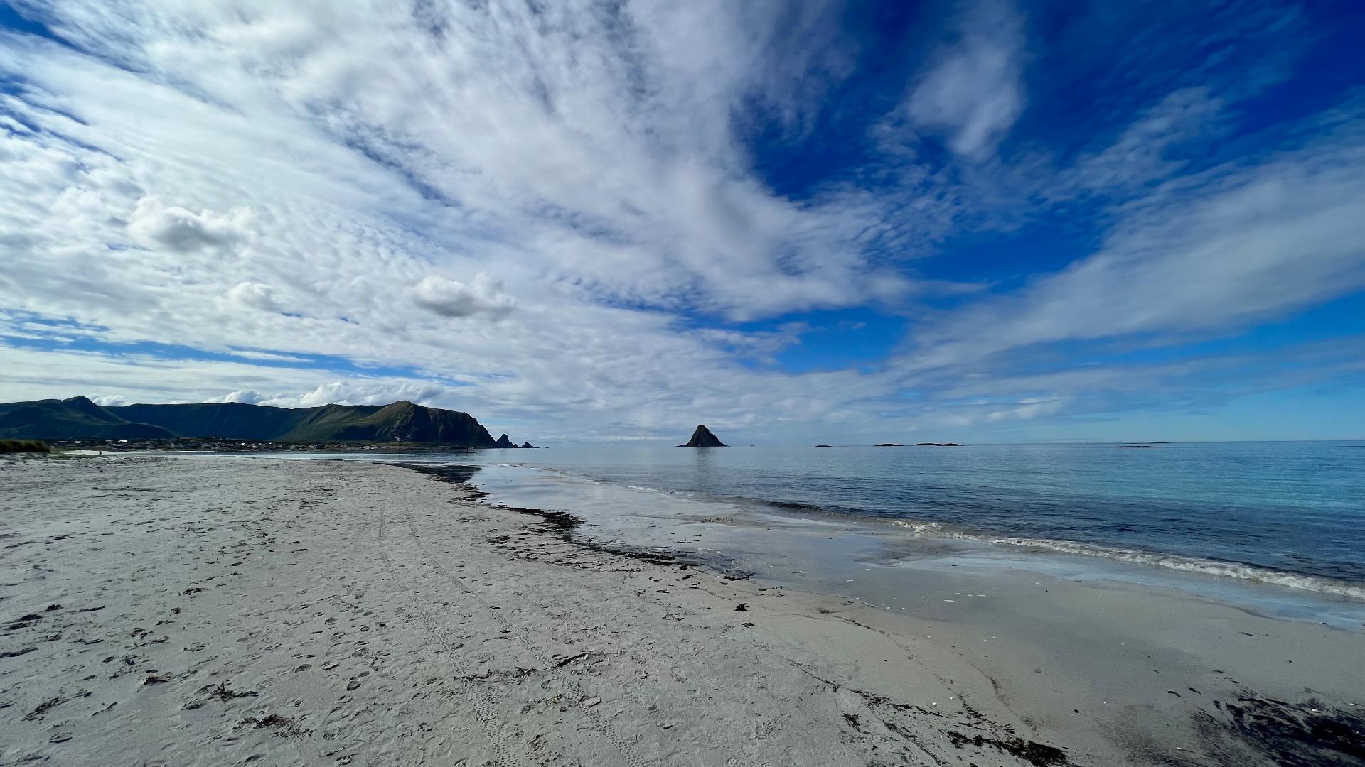
After the steep section at Nyksundskaret, you can either continue to Nyksund or head down to the coast. The coastal section passes Skipsanden beach, where archaeological remains have been found. Artefacts still surface from time to time. If you find something, leave it untouched. Halfway along the coast at Enge there is a shelter and fireplace.
Allow about 6 hours of walking, or 8 hours with breaks. The full route earns a red difficult rating due to the length and the tricky descent at Finngamheia. If you only walk the coastal section between Nyksund and Stø, it is yellow medium. The season runs from June to late September, depending on the year. There is also a radar station near the first summit.
The trail opened in 1992. In 1994, Queen Sonja hiked it and was so taken by the nature that people started calling it Dronningsruta. In 2018, the Norwegian Tourist Association DNT celebrated its 150th anniversary with a series of live television broadcasts of famous hikes led by adventurer Lars Monsen. Dronningsruta was one of them. They did not have sunshine either.
The route is 11.3 km with 800 metres of total ascent. If you extend the hike to include Nyksund, add 2 km and 200 metres. The mountain section runs along a plateau before reaching Finngamheia, where it gets steep. Unlike Besseggen, the ground here is loose earth rather than bare rock, so you have to be more careful on the descent.
After the steep section at Nyksundskaret, you can either continue to Nyksund or head down to the coast. The coastal section passes Skipsanden beach, where archaeological remains have been found. Artefacts still surface from time to time. If you find something, leave it untouched. Halfway along the coast at Enge there is a shelter and fireplace.
Allow about 6 hours of walking, or 8 hours with breaks. The full route earns a red difficult rating due to the length and the tricky descent at Finngamheia. If you only walk the coastal section between Nyksund and Stø, it is yellow medium. The season runs from June to late September, depending on the year. There is also a radar station near the first summit.