Akerselva is the river that runs through Oslo and divides the city roughly in two. It is not a big river; do not imagine the Rhine or the Danube. It is more like a large creek, about eight kilometres long, flowing from the lake Maridalsvannet in the north down to the fjord at Grønland. But what it lacks in size, it makes up for in history and atmosphere.
In the nineteenth century, Akerselva was the backbone of Oslo's industrial revolution. The many waterfalls along its course provided water power, and factories lined both banks: textile mills, mechanical workshops, sawmills and flour mills. At its peak, the river powered over 50 factories. The river also became the unofficial border between east and west Oslo, a social divide that persists to this day. The industrial buildings have long since been converted into offices, restaurants, galleries and apartments, but the brick facades still give the riverbanks their distinctive character.
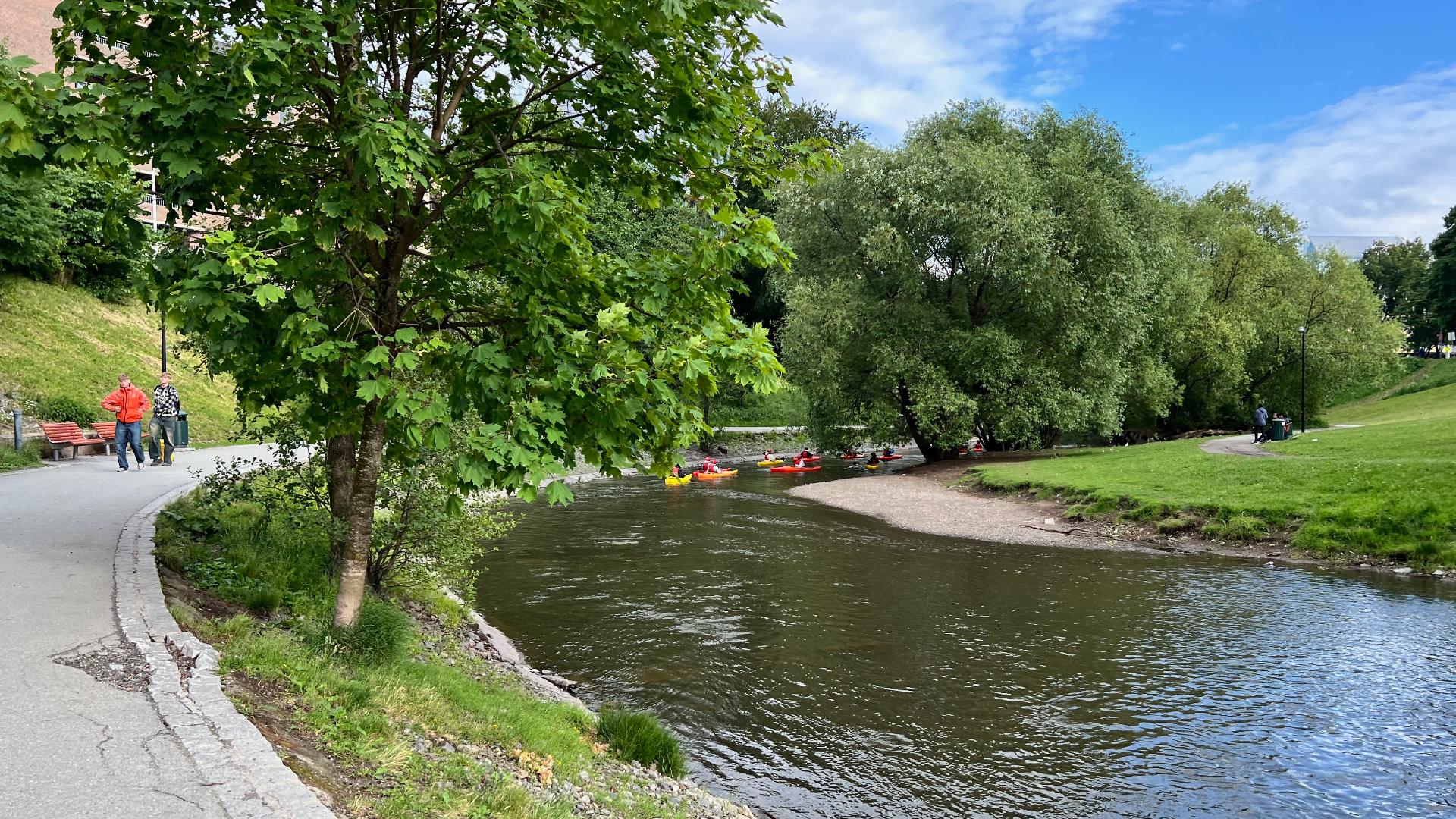
Today there is a walking and cycling path that follows the entire length of the river, from Grønland near the central station all the way up to Maridalsvannet. The walk takes roughly two to three hours at a leisurely pace. Along the way you pass several waterfalls, parks, old factory buildings, and the food hall area of Mathallen and Vulkan. In summer, people try to paddle down sections of the river in canoes or inflatable dinghies, with varying degrees of success. The path ends at Maridalsvannet, which is Oslo's main drinking water reservoir, fenced off to protect the water supply.
The river walk is one of the most pleasant things to do in Oslo on a nice day, and it is free. Start at either end depending on your mood: uphill from Grønland for a workout, or metro to Nydalen and walk downhill for the easy version.
In the nineteenth century, Akerselva was the backbone of Oslo's industrial revolution. The many waterfalls along its course provided water power, and factories lined both banks: textile mills, mechanical workshops, sawmills and flour mills. At its peak, the river powered over 50 factories. The river also became the unofficial border between east and west Oslo, a social divide that persists to this day. The industrial buildings have long since been converted into offices, restaurants, galleries and apartments, but the brick facades still give the riverbanks their distinctive character.
Today there is a walking and cycling path that follows the entire length of the river, from Grønland near the central station all the way up to Maridalsvannet. The walk takes roughly two to three hours at a leisurely pace. Along the way you pass several waterfalls, parks, old factory buildings, and the food hall area of Mathallen and Vulkan. In summer, people try to paddle down sections of the river in canoes or inflatable dinghies, with varying degrees of success. The path ends at Maridalsvannet, which is Oslo's main drinking water reservoir, fenced off to protect the water supply.
The river walk is one of the most pleasant things to do in Oslo on a nice day, and it is free. Start at either end depending on your mood: uphill from Grønland for a workout, or metro to Nydalen and walk downhill for the easy version.